October 2026
Every stage of the mine now ships.
Three weeks of platform work: five new applications, deeper science in the ones you know, and a platform with a new name.
Now live
Five new applications.
Drill & Blast and Mine Operations close the two gaps in the lifecycle. The other three extend it outward — into exploration, the fleet record and site-wide water reporting.
Drill & Blast
Blast design, drilling, charging and initiation records, with a governed handoff to Grade Control.
Explore Drill & BlastMine Operations
Shift targets, readiness, authorisation and execution records, with plan-to-actual by shift. Records; does not dispatch.
Explore Mine OperationsFleet Management
The mine's equipment and operator register, telemetry, maintenance, tyres and fuel. Rebuilt for mining — records, not dispatch.
Explore Fleet ManagementMineral Prospectivity
Evidence layers from open geoscience data, knowledge- and data-driven models, and ranked exploration targets.
Explore Mineral ProspectivitySite Water Account
The site water circuit as one account, reported to the ICMM framework and GRI 303.
Explore Site Water AccountAdvanced
Deeper science in the applications you know.
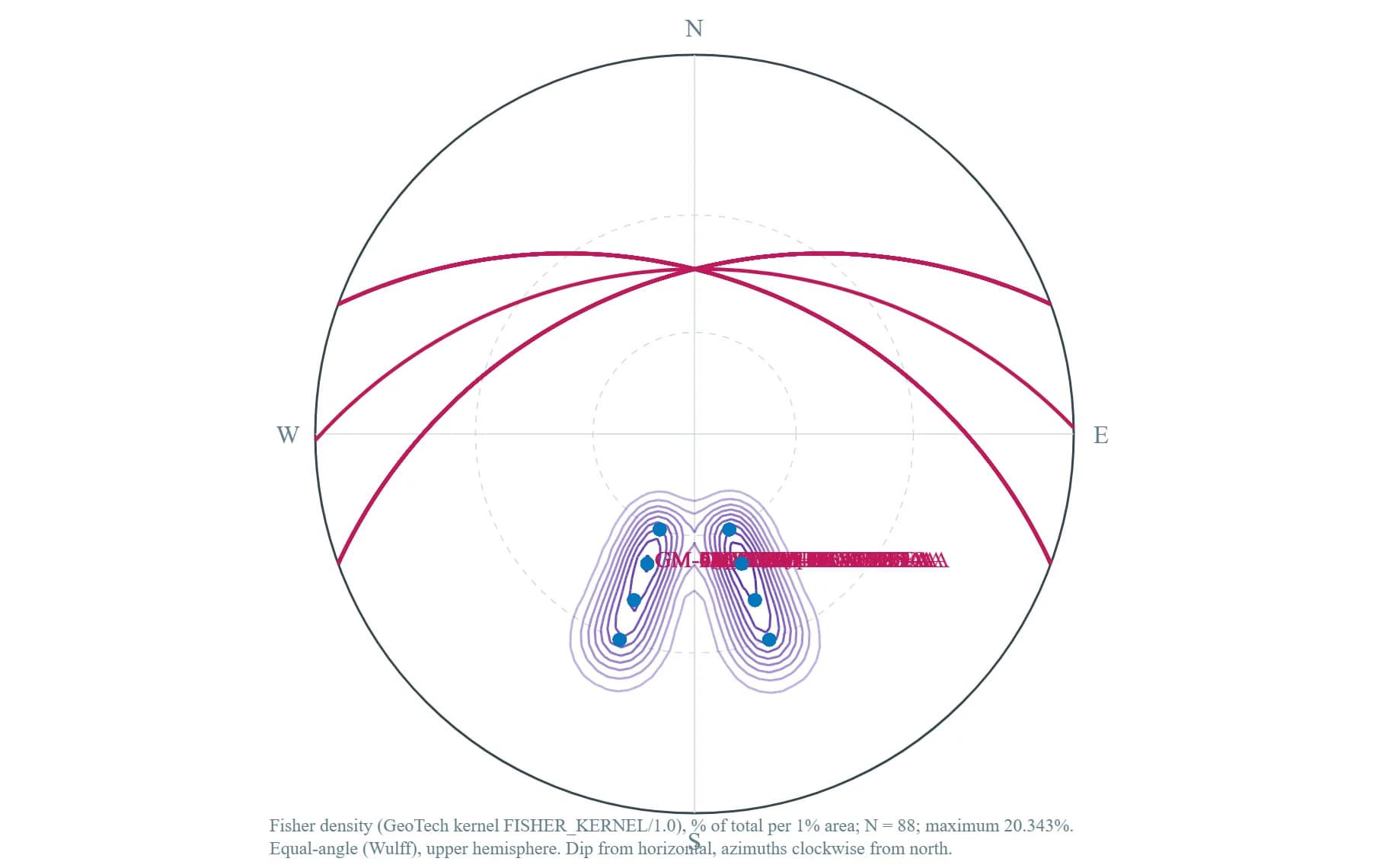
GeoTech Studio adds geomechanics
- Equal-angle and equal-area stereonets, upper or lower hemisphere
- Kinematic screening for planar sliding, wedges and toppling
- Joint spacing and frequency along scanlines and boreholes; strike rosettes
- CPT liquefaction screening — Boulanger & Idriss (2014), Yoshimine (2006), Iwasaki (1982)
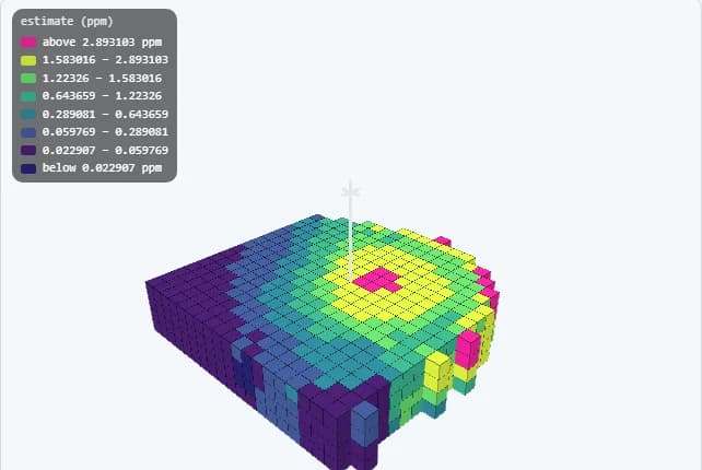
GeoMine Studio gets a new 3D viewer
- Perceptual colour scales, editable class breaks and saved display presets
- Contours drawn in 3D and as 2D sections
- Drillhole traces coloured by logged unit, with collars and tube channels
- 50+ governed compute kernels behind it, up from 30
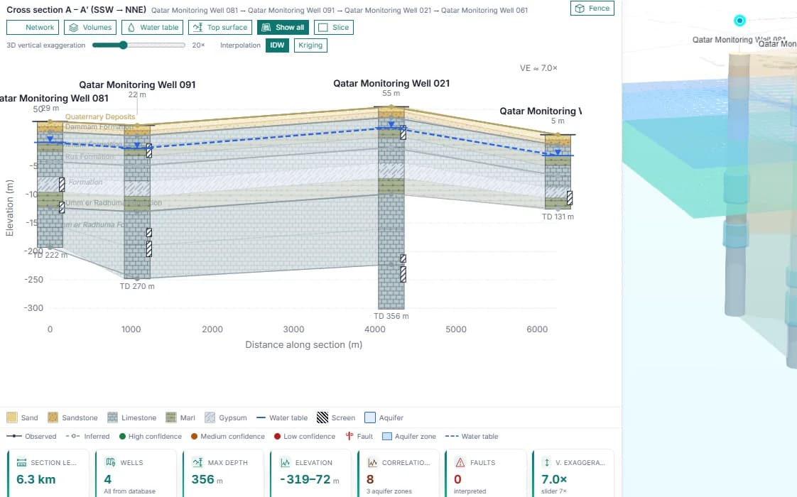
HydroGeo Studio draws sections in 2D and 3D
- Cross-sections through monitoring wells with formations, water table and screens
- The same wells as a 3D fence diagram
- MODFLOW 6 groundwater modelling
- Water quality screened against the WHO drinking-water guidelines (2022)
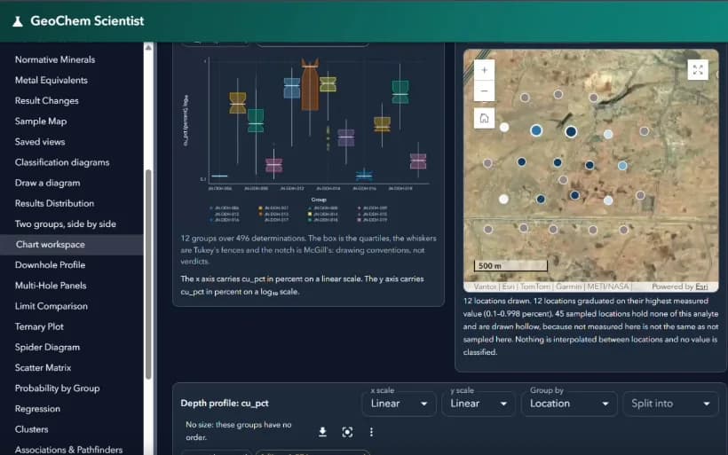
GeoChem Studio opens a chart workspace
- Box plots, ternary and spider diagrams, scatter matrices, clusters and t-SNE
- Associations and pathfinder views beside the sample map
- Robust distance five times faster, on up to 2,000 samples (was 400)
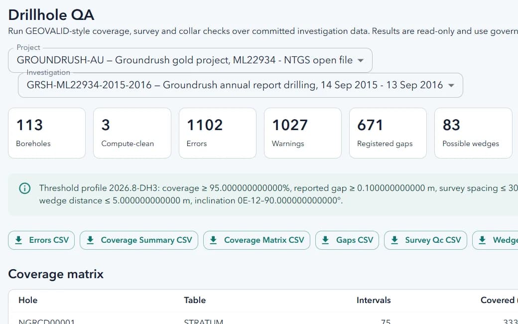
DataHub checks drillholes before modelling
- Coverage, survey and collar QA over committed investigation data
- Proven on a public NTGS open-file gold project: 113 holes checked
- Errors, gaps and possible wedges exported for correction
Platform
One platform, a new name.
STS DigiMine Platform
One sign-in and one home page, with applications grouped as Geoscience & Exploration, Hydrogeology & Water, and Mine Planning & Operations.
Scientist becomes Studio
GeoTech, GeoChem, GeoMine, HydroGeo, Mine Dewatering and Tailings are now Studios. Same applications, clearer names.
English and Russian throughout
The applications now run fully in Russian as well as English, with a reviewed mining and geoscience terminology.
Governed by default
Grade Control refuses hand-entered model grades; Open Pit Planning keeps designs in development until the slope is approved.